Popular Birding Places
Utah County
|
 |
|
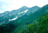
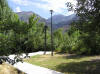
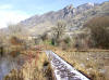
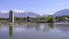
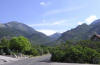
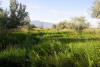
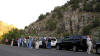
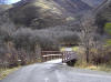
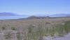
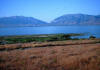
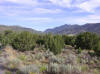
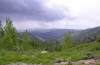
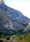
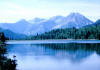
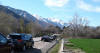
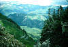
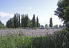
Alpine Loop by Merrill Webb
©Merrill Webb
|
|
Clickable Map
| Print
out Map and Information -
Part One -
Part Two | |
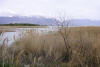
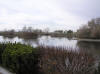
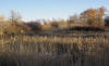
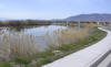
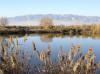
Allred's Pond
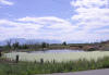 |
Directions: Take UT 73 (Main Street) west of Lehi about 2 miles, and turning
north on 10400 West just past the Jordan River crossing. The pond is on the right side of the road about 1/2 mile north. |
|
Details |
|
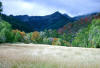
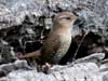
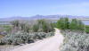
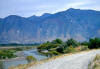
Alpine
Loop
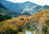 |
Directions: The Alpine Loop can be accessed from either Provo
Canyon (taking the road to Sundance) or American Fork Canyon. |
|
Details |
|
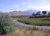
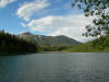
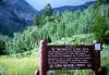
American Fork Canyon
 |
Directions: Access to the canyon
is either by way of 100 East in Pleasant Grove (which becomes Canyon Road)
or by way of the Highland/Alpine exit off I-15 (#284), following the signs
to Timpanogos Cave |
|
Details |
|
|
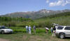
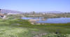
American Fork Marina
 |
Directions: Access to the American
Fork Marina is via 6000 West, American Fork, N 40º 20.500' W 111º 48.070'. |
|
Details |
|
|
Anderson Park
in
Pleasant Grove (Has been "upgraded" and become
less desirable for birding)
 |
Directions: Go east on 200 South (Battle Creek Dr.) in Pleasant
Grove. When you get to 950 East, turn left (north) and go about a block and a
half to the park.
|
|
Details |
|
Battle Creek Canyon
(Submitted by Eric Huish)
 |
Directions: Battle Creek Canyon is located at the East end of 200
South (Battle Creek Dr.) in Pleasant Grove, Utah County. |
|
Details |
|
Benjamin Slough
 |
Directions: Take 400 North in Spanish Fork and go
west about 5 miles to 4800 West (that's the first place the road
turns) |
|
Details |
|
Bennie Creek
 |
Directions: Bennie Creek
can be accessed from the Birdseye side or from the Nebo Loop up Payson
Canyon. See Details. |
|
Details |
|
Bicentennial Park,
(Provo)
 |
Directions: From the intersection of 300 South and 700 East in
Provo, go south (southeast) on State Street about 1 mile to 1440 South and
turn left (east). There's a gas station on the corner right next to a Chinese
restaurant "First Wok". Go a couple of block straight east into the
parking lot. |
|
Details |
|
Big Spring Hollow,
(South Fork, Provo Canyon)
 |
Directions: At the mouth of Provo Canyon, take US 189 going up
the canyon about 5 miles to Vivian Park. Turn right across the bridge and
railroad tracks, through Vivian Park and continue up South Fork Road about 3 1/2 miles and turn right at the National Forest access sign. (They should
be putting up a sign pretty soon, for the new park at the mouth of
Big Spring Hollow) |
|
Details |
|
Botany Pond--BYU Campus
 |
Directions: From University Avenue in Provo, turn east on 800
North Street. The Botany Pond and area of trees and grass is located
between 200 East and 500 East. (The Botany Pond area is connected to
trails the go through an area of thick bushes and trees along a canal that skirt
the BYU campus and is a good area for birding). |
|
Details |
|
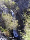
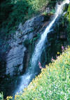
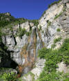
Bridal Veil Falls
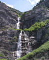 |
Directions: Take the 800 North, Orem exit of I-15
(exit #273) going east on UT 52. After about 4 miles bear left at the US 189
intersection going up Provo Canyon. After about 2 1/2 miles you can turn off
at the Bridal Veil Falls/Nunn's Park parking lot to access the Provo River
Trail or continue about a half mile to the Bridal Veil Falls overlook which
is directly in front of the falls. |
|
Details |
|
Bunnel's Pond
 |
Directions: From Geneva Road in west Provo:
Go west on 1520 north for about 3 blocks and turn right into this short dead
end road which ends by the pond |
|
Details |
|
Broad Canyon
(Auto Tour)
Details
|
Camelot Woods
 |
Directions: From the northernmost Springville exit of
I-15, (exit 261) turn to the west, then immediately turn north and park. |
|
Details |
|
Cedar Valley
(Auto Tour)
 |
Directions: Begin the tour at the Lehi Exit of I-15:
exit 279 heading west Details |
|
Chimney Rock Road
 |
Directions: From Elberta, go north on UT 68. At mile marker 7
turn west on Chimney Rock Road (also known as the road to Allen's Ranch) and
drive about 5 miles (birding along the way) until you come to Chimney Rock.
You can continue a short distance to Cedar Valley and take the Homansville Pass
Road which goes south (to the left) about 6 miles come out on US 6 about 2 miles
east of Eureka. Bird the sagebrush slopes and pinyon-juniper hills
along the way. |
|
Details |
|
Diamond Fork Canyon (Auto
/ Walking Tour)
 |
Directions: To get to Diamond Fork Canyon from
Provo, drive south on I-15 to Exit number 258 and travel east on highway 6
toward Spanish Fork Canyon, taking twenty-five to thirty minutes. Take the
turn-off to Diamond Fork Canyon exit, which is 11. 5 miles east of I-15. You
are now on Forest Service Road #029 at N 40 01.780' W 111 30.410'. |
|
Details |
|
Dry Creek Canyon
~ taken from a
UCB newsletter article by Merrill Webb
 |
Directions: From Main Street in Alpine turn east on 200 North.
Go to 200 East (becomes Grove Drive) and turn north and continue about 1.8 miles
to a "T" in the road. Turn Right then immediately left and follow the road to the parking area
for the Dry Creek Trailhead.
|
|
Details |
|
East Bay
 |
Directions: From the University exit (Exit
263) of I-15 in south Provo, go east on 1860 South (the street just south of
the tall Novell building). Go through two stoplights and turn right at
700 East (Industrial Parkway -- signed only on the north of the
intersection) which has signs indicating access to Kuhni Road and 1910 South. This road turns
immediately into 1920 South and skirts around the east side of the East Bay Golf
Course along 950 East which becomes Kuhni Road. |
|
Details |
|
Elberta Slant Road
(Submitted by Merrill Webb)
 |
Directions: From Provo take I-15 south to the Santaquin exit.
Turn right towards the town of Santa quin and drive 10.6 miles to Elberta going
through the towns of Genola and Goshen on the way. At the Elberta
crossroad turn right and drive for .9 miles. Immediately after crossing
the roalroad tracks turn left at 1280 West 146 South on to a dirt road.
This is the beginning of the Elberta Slant Road. |
|
Details |
|
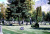
Evergreen Cemetery
 |
Directions: Go south on Main Street in Springville
and bear right at about 600 South on Hwy. 89 which go back over the road and
continues in a southeasterly direction. Continue about a mile passed
1600 South (Springville) and take the next right (about 1600 North -
Mapleton) and go about 3 block to the cemetery. |
|
Details |
|
Fifth West (5th West)
 |
Directions: Drive south on University Avenue turning
west at 920 South. Drive past where the road passes underneath the I-15
Freeway, then turn south on a road named "Frontage Road", which turns into
500 West. Drive to 1820 South and park along the street. You can walk
on the dirt road that continues to the south. |
|
Details |
|
Four Thousand
West Wetlands in Lake Shore (submitted by Merrill Webb)
 |
Directions: From Provo drive south on I-15 to the
second Springville Exit (number 260). Turn right onto 400 South and
drive 4.0 miles to a T-junction. Turn right onto 4400 South and in .3
miles cross the Spanish Fork River into Lake Shore and drive another 1.5
miles to 5200 South and turn right. Drive one mile west on 5200 South
to 4000 West and turn right onto a dirt road. Drive .5 miles to a
green, steel gate on the right and an observation tower. |
|
Details |
|
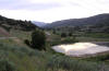
Geneva Cooling Ponds
 |
Directions: The Geneva Cooling Ponds are just south of the Lindon Marina and west of Geneva Steel
Plant on West Geneva Road. Access is from Geneva Road at 200 South, Lindon or
400 South, Orem. From either of these proceed west toward the lake. |
|
Details |
|
Goshen Bay Road (Extension
of Center Street going north from Goshen)
 |
Directions: Go north on Center Street in Goshen (this becomes
Goshen Bay Road). In about a mile the paved road (14000 South) goes
off to the left. The Goshen Bay Road continues to the north for about 1 1/2
miles. |
|
Details |
|
Goshen Canyon (also
in Juab County)
 |
Directions: Go south on Center Street in Goshen (this becomes
Goshen Canyon Road). The mouth of the Canyon is about 3 miles south of
town. |
|
Details |
|
Grove Creek Canyon
 |
Directions: Grove Creek Canyon is located at the East end of
500
North (becomes Grove Creek Dr.) in Pleasant Grove, Utah County. |
|
Details |
|
Green's Pond,
[Secret Pond]
 |
Directions: 1. Go north on Center Street in Goshen (this becomes
Goshen Bay Road). In about a mile turn left on the paved road which
is 14000 South. Go about 3/4 of a mile to the gate to Phil Green's
farm. There's a small pond on the south side of the road and a larger one
on the other side of the fence. Phil Green is a nice fellow, please
respect his property.
2. Go west of Goshen on US 6 a little less than 1/2 mile and turn right
(north) on 11130 West. Go less than a mile to the "T" in the
road and go left (west) to the gate as mentioned above. |
|
Details |
|
Highland Glen Park
 |
Directions: Turn west of 4800 West about 1/2 mile
south of Highland Highway and just north of Lone Peak High School. The
road goes along the west side of the high school and has several large speed
bumps then it curves right going down the hill into the lowlands of the
park. |
|
Details |
|
Hobble Creek Parkway
 |
Directions: Take the southernmost Springville Exit of I-15
(#260) (3900
South Utah County / 400 South Springville) and go to 1300 East (and 400 South)
in Springville and turn right on Canyon Dr. Go about 2 miles (the road
will be going south and then curve eastward) to the mouth of Hobble Creek Canyon
and a catch-basin dam. Go one mile past the dam and turn right at the
"Hobble Creek Parkway" road sign. The parking lot is several hundred feet
down the road. |
|
Details |
|
Inlet Park (See
Jordan River Sportsman Access)
|
Jones' Ranch,
(Payson Canyon)
 |
Directions: Take 600 East Street in Payson to the
canyon road. Go about 10 miles up Payson Canyon about 1/4 mile past
the second Payson Lakes turnoff (just before the turn off to the Payson
Lakes Guard Station. The house and coral to the west is Jones' Ranch
and the riparian area with the stream running through, is Jones' Ranch Flat. |
|
Details |
|
Jordan River Airfield (Model
Airplane Airfield, R/C Modelport)
 |
Directions: Take
Lehi Main Street (I-15 exit
#279) west 2.7
miles to 2300 W. Take 2300 West, South 2.3 miles. The Parking area is on the
right side of the road. |
|
Details |
|
Jordan River Sportsman Access &
Inlet Park
(See also Provo / Jordan River Parkway)
 |
Directions: Take
Lehi Main Street (I-15 exit
#279) west 2.7
miles to 2300 W. Take 2300 West, South 2.3 miles. The Parking area is on the
right side of the road. The trails take of accross the road towards Utah
Lake. |
|
Details |
|
Knolls
 |
Directions: Access is from Highway 68 (Redwood Road)
at mile marker 19 (N 40º 12.437' W 111º 53.673'). Take the gravel road to
the lake. |
|
Details |
|
Kuhni's Wetlands (See
Provo Wetlands WMA)
|
Lake Mountain (See
Soldiers Pass)
|
Lake Shore Sportsman Access (4000
West)
|
|
Directions: Access is by going north on 4000 West,
(Benjamin), which turns into a dirt road north of 5200 South where it enters
marsh land |
|
Details |
|
LeBarron Point
 |
Directions: On the east side of the south end of Utah Lake, west of West Mountain, LeBarron
Point sticks out into the lake, N 40 02.972' W 111 52.319. |
|
Details |
|
Lehi Section of the Jordan River
Parkway
 |
Directions: From 2300 West and 1500 North in Lehi, go west
for about a half mile to the Jordan River.
|
|
Details |
Lincoln Beach
 |
Directions: See Details for complicated directions |
|
Details |
|
Lincoln Point & West
Mountain (Auto Tour)
|
Lincoln Point
 |
Directions: (These are directions for the direct, easy route to
Lincoln Point, see Lincoln Beach above for directions through an excellent
birding route) Take Exit 260 (I-15) and go south on Spanish Fork
Main Street to 400 North. Turn right and go west about 5 miles on what
becomes 7300 South to 5600 West. Jog right to 7200 South and go left (west) four
blocks where the road turns right and goes to 6400 South. Turn left on
6400 South and follow the road as it turn right and goes about 2 miles, just
past Lincoln Beach, and curves left around Lincoln Point. |
|
Details |
|
Lindon Marina
 |
Directions: Take I-15 exit 273 drive West then
turn right at Geneva Rd. (first light). Turn left at the next light (200 S
Lindon/2000 N Orem). Drive west until you come to the T in the road (the
gate into the garbage dump will be in front of you) Turn Left. Follow this
road, the road will curve to the right, go over the railroad track then
curve left again right in front of the entrance to the Lindon Marina. |
|
Details |
|
Lower Hobble Creek WMA
 |
Directions: Go west on Exit 261 (Springville exit).
Turn left (main road) to go on the frontage road. Continue about a quarter
of a mile to a small parking lot along the road with a large sign for the
management area. |
|
Details |
|
Lower Provo River Parkway (Walking Tour)
|
Maple Canyon (Whiting
Campground)
 |
Directions: Drive east on 400 N. in Mapleton.
At the mouth of the canyon this road will turn slightly to the south and
become Maple Canyon Road. This road continues for about 1.6 miles and ends
at the back of the Whiting Campground at a small trailhead parking lot. A
very easy to moderate hiking trail heads North and East from this trailhead
parking lot. |
|
Details |
|
Manning Canyon
 |
Directions: Go west from Fairfield on UT 73 about 1 1/4 miles (mile
post 19.1). Turn right on the dirt road and go about a mile to the
bulletin board for Fivemile Pass Recreation Area. |
|
Details |
|
Mill Race Sportsman Access, [Provo Bay]
 |
Directions: Exit I-15 at the Mountain Springs
exit (exit 261, the northern most Springville exit) and turn
west, then north passing Camelot Woods on your left and continuing on the
frontage road.
(See Provo Bay) |
|
Details |
|
Monk's Hollow
~ taken from a
UCB newsletter article by Merrill Webb
 |
Directions: In Diamond Fork Canyon (Billie's Mountain quad map)
about two miles up from the campground the forest service has recently
constructed a new group picnic site just across the stream at a location
known as "Monk's Hollow". |
|
Details |
Mountain Springs Park
(see Springville Industrial Park)
|
Mount Timpanogos Trail
 |
Directions: Go east from Exit 272 ( I-15) in Orem on UT 52 (800 North)
to the mouth of Provo Canyon. Follow the road left on US 189 and go up the canyon
about 6 miles and turn north on UT 92 going toward the Sundance Resort. Go
about 5 miles, just past Aspen Grove to the Mount Timpanogos Trailhead. |
|
Details |
|
Nebo Loop / Payson
Lakes - Auto Tour (80 miles)
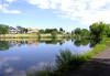
Oxbow, Provo River Parkway
 |
Directions: Take the Provo Center Street Exit -- 265(B)
off I-15 in Provo and go about 2 miles
west towards Utah Lake State Park. Just before you get to the fee station
for the state park, turn right and go about a block and turn right on Boat
Harbor Road. Go about a mile to a parking lot that's right next to the
road. Take the trail going up stream for about 100 feet where the tail
splits and goes around the oxbow. |
|
Details |
|
Page Fork ~
taken from a
UCB newsletter article by Merrill Webb
 |
Directions: Drive up Spanish Fork Canyon and turn right at the
junction with Highway 89 towards Thistle and Birdseye. After the Birdseye church
take the third right (Nebo Creek) and drive 1.5 miles past the forest boundary
fence and cattle guard to Page Fork. Turn left (south), ford the stream and go
approximately 100 meters to the cattle guard. |
|
Details |
|
Payson Lakes, Payson Canyon
 |
Directions: Take 600 East Street in Payson to the canyon
road. Go about 9 miles up Payson Canyon. There are two roads going
to the lakes. The first road goes to two smaller lakes and the second road
goes to the large one.
Area Map: Payson Lakes Area Map
("Birds of Utah" booklet)
Tour: Nebo Loop - Auto Tour
("Birds of Utah" booklet) |
|
Details |
|
Payson Lakes Guard Station
(Rock Spring)
 |
Directions: Take 600 East Street in Payson to the
canyon road. Go about 10 miles up Payson Canyon about 1/4 mile past
the second Payson Lakes turnoff (just before the turn off to the Payson
Lakes Guard Station. The riparian area just below the guard station is
a very good place bird as well as the aspen tree to the west. |
|
Details |
|
Powell Lake
 |
Directions: Go west on Lehi Main Street about 3 miles. Turn
left (south) onto Willow Lane (3130 West) and go to the stop sign a couple
of blocks away. Turn right onto Willow Reed (340 South) and Powell
Lake will be about 1 block away. |
|
Details |
|
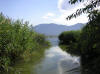
Powell Slough
 |
Directions: Powell
Slough is a large marshy area near the Orem Water Treatment Plant, with a
number of waterways winding through the reeds providing habitat for American
Coots, Common Moorhen and other waterfowl. ~ Robin Tuck
|
Weather
Forecast | Topomap
| Street Map (enter:
Orem, UT ) * | |
|
Details |
|
Provo Airport Dike (Auto
/ Walking Tour)
 |
Directions: To get to the Airport Dike (see Provo
Airport Area Map), take the Provo Center Street west exit off I-15
(#265[B]).
Continue west on Center Street towards the Provo Boat Harbor. The Airport road,
3110 West, runs south off Center street about one mile past the Geneva road
intersection and is marked by a sign saying "Airport". Turn left here and go 0.9
miles to the beginning of the Provo Airport Dike, N 40 13.548' W 111 42.794'. |
|
Details |
|
Provo Bay
(See Mill Race)
 |
Directions: Go west on Exit 261 (Springville exit). Where
the road turns left to go on the frontage road, turn right and go past "The
Forest of Camelot" to the dirt road along the east side of Provo Bay. |
|
Details |
|
Provo City Cemetery
 |
Directions: The Provo City Cemetery has a large number of old mature deciduous and coniferous trees
which attracts a number of small birds. Daytime access is west of State Street (US Highway
89) at 800 South. Birding in the Cemetery is best in the winter. |
|
Details |
|
Provo / Jordan River Parkway
|
Provo Wetlands WPA (Kuhni's Wetlands)
 |
From the University exit (Exit 263) of I-15 in
south Provo, go east on 1860 South (the street just south of the tall Novell
building). Go through two stoplights and turn right at 700 East
(Industrial Parkway -- signed only on the north of the intersection) which
has signs indicating access to Kuhni Road and 1910 South...
see details |
|
Details |
River Lane / Sandy Beach Sportsman
Access
 |
Directions: From the southern-most Springville
Exit of I-15 (#260, 400 South). Go west onto SR 77 (4000 S. Utah Co.)
and drive about 4 miles to a T-junction. Turn right onto 4400 South and then
in about .2 miles turn right onto River Lane.. |
|
Details |
Rock Canyon
 |
Directions: Go about a half mile past the Provo Temple on 2300 North
in Provo to Rock Canyon Trailhead Park. |
|
Details |
|
Salem Park Pond
 |
Directions: From Geneva Road in west Provo:
Go west on 1520 north for about 3 blocks and turn right into this short dead
end road which ends by the pond |
|
Details |
|
Salem Pond
 |
Directions: From the North: From Main
St. in Spanish Fork go south about 4 miles out of town (becomes UT 198) to
the middle of Salem. Turn left on 300 West and then immediately left
on 200 South and you'll run into the pond in about a block.
From the West: From 100 North. in
Payson go east about 3 miles out of town (becomes UT 198) to the middle of
Salem. Turn left on 300 West and then immediately left on 200 South
and you'll run into the pond in about a block. |
|
Details |
|
Sandy Beach Sportsman Access / River
Lane See River Lane
|
Saratoga Springs Park
 |
Directions: From the Main Street (also Redwood Road)
in Saratoga Springs, go to Centennial Blvd. (1660 South) and turn toward the
lake. In a few blocks the road will make a strong curve to the right.
The park is right on this curve toward the lake. |
|
Details |
|
Sheep Creek
 |
Directions: Drive about 20 miles up Spanish Fork Canyon on US 6
toward Price. Turn left (north) onto Sheep Creek Road (FR 051). |
|
Details |
Silver Lake Flat
 |
Directions: From I-15 take exit 284 (Highland, Alpine) and go east
about 7 miles to the mouth of American Fork Canyon. Proceed up the canyon about
6 miles, and turn left and go about 2 1/2 miles to Tibble Fork Reservoir.
Take the road to the left going to Granite Flat and go about 3/4 of a mile and
turn right on a small, steep, winding dirt road that the leads to Silver Lake
Flat a couple of miles away. |
|
Details |
|
Skipper Bay Trail
(Part of the Provo River / Jordon River Parkway going north from Utah Lake State
Park)
 |
Directions: Go west on Center Street in Provo until you cross the
bridge across the Provo River (just before you enter Utah Lake State Park).
Turn right immediately and go north about a block to the "T" where you turn left
into a small parking lot. The trail goes north from the west end of this
narrow parking lot. |
|
Details |
|
Soldiers Pass (Lake
Mountain)
 |
Directions: Drive approximately 16 miles south on SR 68 from from the
Pioneer Crossing and SR 68 intersection. Turn right onto Soldiers Pass Road
(gravel road running west). Or from Elberta drive approximately 16 miles north
on SR 68 and turn left onto Soldiers Pass Road. Follow the main gravel roads or
venture onto trails with a high clearance vehicle. |
|
Details |
|
South Fork of Provo Canyon
(see Vivian Park and
Big Spring Hollow )
|
Spanish Fork River Park
 |
Directions: Go about 8 miles up Spanish Fork Canyon on US 6 /
89. Go just past the Diamond Fork Canyon Road and turn right onto a dirt
road the goes across the railroad tracks. Proceed up the road along the
river until the road turns across a bridge to an old railroad grade. The
birding is good along both sides of the river. |
|
Details |
Spanish Fork
River Trail
 |
Directions:
Middle access: Go either from
River Bottoms Road going south on 1100 East or from 8800 South St. going
north on 1150 East to the bridge across the Spanish Fork River. There
is parking along the road and a message board with information about the
trail. |
|
Details |
Spring Lake
|
|
Directions: Spring Lake is a shallow spring-fed pond
about 2 miles south of Payson on State Highway 6. Turn east on 12400 South
and go one block down the hill. This pond generally has a number of ducks on
the north end, which has a road around it with picnic tables. |
|
Springville Industrial
Park (Mountain Springs Parkway)
 |
Directions: Take the first Springville exit if your
heading southbound on I-15. Head east when you get off of the exit, go past
the first light and the Flying J and Maverick gas stations. Turn right on
the second light which is posted as 1100 west. |
|
Details |
|
Squaw Peak Trail
 |
Directions: Go east from Exit 272 ( I-15) in Orem on UT 52 (800 North)
to the mouth of Provo Canyon. Follow the road left on US 189 and go up the canyon
about 1.9 miles Turn right on the paved road. This road goes
to the Squaw Peak overlook (overlooking Utah valley), to Hope campground, at
which point the pavement ends and a good graded road continues to Rock Canyon
Campground. From here the road becomes rough as it continues to Hobble
Creek Canyon. |
|
Details |
|
Stewart Falls
 |
Directions: Go up Provo Canyon and take the
Sundance Ski Resort turnoff. There are two ways to get to the falls:
(Aspen Grove tail) From the northwest end
of the northern-most Aspen Grove parking lot take the trail the skirt the
west end of the amphi-theater. (It's about 1.5 miles to the falls.
(Sundance Nature Tail) You can get there
from Sundance, but you may have to ask for directions. |
|
Details |
|
Swede Lane
|
|
Directions:To get to Swede Lane take exit 260 from I-15 and head West. Stay on this road
[US 77, 4000 W.] (it makes a few turns) until you pass a canal. There will be marshy habitat on
your right. You will get to a point where the road makes a full turn to the
South (left) [about 4 miles from I-15] instead of following the road to the South take the dirt road to
the North [2750 W.]. If you look closely there is a faded street sign marking the road as
Swede Lane. The dirt road extends to the North for one field then takes a Left.
At the end of the next field the road makes a 'T' junction, stay right and just
follow the road for great birding. (Instructions by Chad Jardine) [added
information is in brackets] |
|
Thistle Dam (the
riparian area down stream)
[see Spanish Fork River Park]
|
Timpanogos Trail
(see Mount Timpanogos Trail)
|
Timpanogos Wastewater Treatment Plant
 |
Directions: Take The 2nd Pleasant Grove Exit off I-15 (Exit #275) then
turn West. Go straight through the next intersection then turn left after the
railroad tracks. You are now at the treatment plant. Drive straight through the
treatment plant until you reach the T in the road at the ponds. Go right or
left, this is a loop road around the ponds and will bring you back to the same
spot. |
|
Details |
|
Timpooneke Road
 |
Directions: At Timpooneke campground a dirt road takes off to the
north and winds around to the front of Mount Timpanogos. The
distance from the mouth of American Fork Canyon to the Timpooneke Campground is 8.4 miles.
There is no indication at the campground and trailhead that this is the start of the
Timpooneke road. Enter the campground, driving by the pay booth (no fee is necessary) for
.8 miles. The road turns to dirt and you have come to a "Y". To the left is the
campground and a riparian habitat with a beaver pond. Turning to the right is the
Timpooneke road. |
|
Details |
|
Timpooneke Trail
 |
Directions: From the mouth of American Fork Canyon, go 8.4 miles along
the Alpine Loop road and turn right to the Timpooneke Campground.
Go a short distance past the campground host trailer to a parking lot on
the left and the Timpooneke Trailhead. The trail leads to the summit
of Mt. Timpanogos about 9 miles away, but is a nice place to bird as far up as
you'd like to go. |
|
Details |
Tintic Loop (Near Eureka)
 |
Directions: From Elberta go west 3.5 miles on US 6 and bear left onto
a small asphalt road. This is the beginning of the loop. See
details for specific stopping places on the loop. |
|
Details |
|
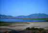
Utah Lake State Park
(Submitted by Robin Tuck)
 |
Directions: The Utah Lake State Park is at the west end of Provo
Center Street at Utah Lake. N 40º 14.215' W 111º 44.016'.
|
|
Details |
|
Vivian Park
(Provo Canyon)
 |
Directions: Take Exit 272 of I-15 in Orem and go east on 800 North (UT
52) about 4 miles to the mouth of Provo Canyon. Keep left and continue up
the canyon on US 189. About 5 miles up the canyon turn right and cross the
bridge to Vivian Park. (The Tail along the south side of the river,
going downstream, has good riparian and marshy areas)
|
|
Details |
|
Wardsworth Creek
~ from a
UCB newsletter article by Merrill Webb
 |
Directions: Access is by a paved road which goes up the right hand
fork of Hobble Creek Canyon a little over 7 miles east of Kelly's Grove and
about 1/2 mile past Balsam Campground. The trail starts at a green gate just
as the road veers south across the stream and becomes a gravel road.
|
|
Details |
|
Warm Springs Wildlife Management
Area
 |
Directions: Go west from Exit 244 (I-15) in Sanatquin on US 6 about
4.4 miles. Turn left after the railroad tracks and go about 0.6 miles.
Turn left over the railroad track and immediately go right to the parking lot.
|
|
Details |
|

|