Spanish Fork River Trail


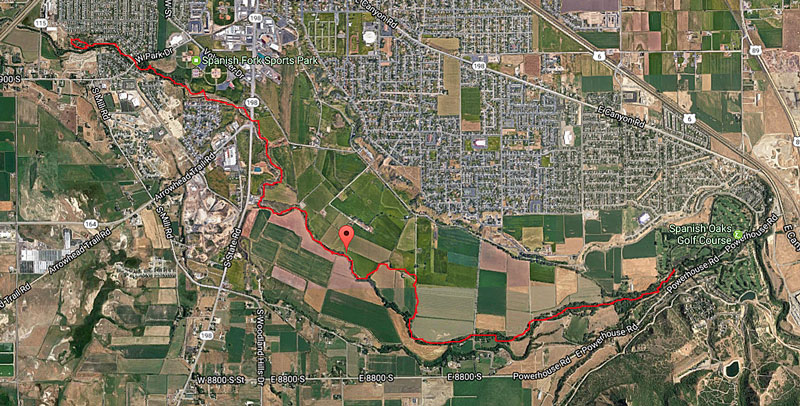
Spanish Fork River Bottoms Area    from Google Maps
  

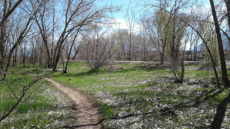
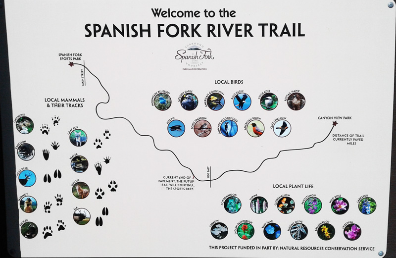
Description:  A paved and developed tail, about 5 miles long, along the Spanish Fork River starting from Canyon View Park (just west of the Spanish Oaks Golf Course) going along the Spanish Fork River to the Spanish Fork Sports Park and continuing to an Urban Forest loop at the west end (just east of I-15).

Directions:
     East access:
 Go to the Canyon View Park just west of the Spanish Oaks Golf Course on Powerhouse Road which comes of of US 6 a mile from the mouth of Spanish Fork Canyon and goes southwest.  Turn right into Canyon View Park and continue around the pond to the parking lot at the end of the road .  The trail takes off at the southwest corner of the parking lot.
     Middle access:  Go either from River Bottoms Road going south on 1100 East or from 8800 South St. going north on 1150 East to the bridge across the Spanish Fork River.  There is parking along the road and a message board with information about the trail.
      Sports Park access:  Go to about 900 South on Spanish Fork Main St. and turn west on to Volunteer Drive.  Go about a block to the entrance of the Sports Park and turn left.  Go to the southernmost part of the parking lot which is close to the trail.  (There is a "forest loop" a few blocks downstream and there's a good tree area a few blocks upstream on the other side of the Main Street underpass).
      Urban Forest access:  Go to about 900 South on Spanish Fork Main St. and turn west on to Volunteer Drive.  Go past the Sports Park to West Park Drive and turn left.  Continue to Spanish Fields Dr. just before the river bridge and turn right. Go to 590 South and turn left.  Continue a couple of blocks to a cul-de-sac parking area right next to the Urban Forest.

Birding:  There are four distinct areas corresponding to the four access points above.  The one nearest the mouth of the canyon attracts more foothill and canyon birds like Steller's Jays.  The middle section goes through cultivated fields and along an irrigation canal where you might see American Kestrels, blackbirds, and meadowlarks.  The Sports Park access is a good way to get to the section just east of Main St. where there's a substantial area of old trees and bushes.  The Urban Forest area is surrounded by a paved path but has dirt paths through out from which you might observe warblers and other birds in a more "private" setting.

Specialty Birds:  Blue Grosbeak, Juniper Titmouse, Yellow-breasted Chat, Steller's Jay, Evening Grosbeak

     eBird Data:   | Spanish Fork River Trail  |  Salem Pond  |  North Salem Marsh |

     Nearby:    | Salem Pond | Spanish Fork River Park | Benjamin Slough |


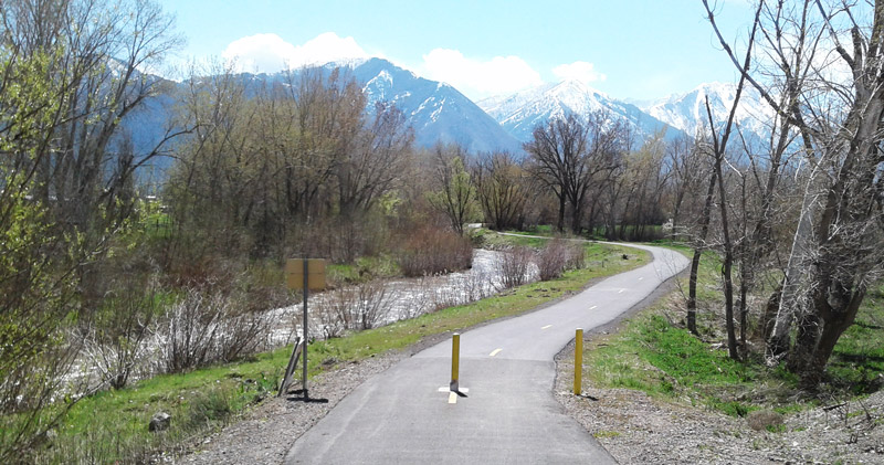
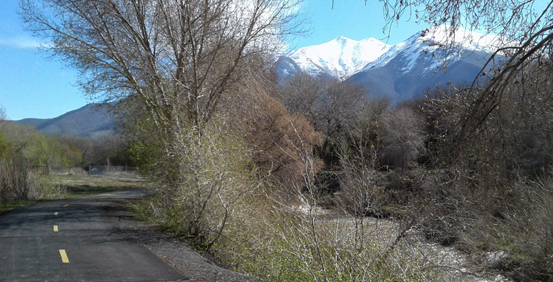
                                    Just Down Steam from Canyon View Park       by Staff Photographer    Šutahbirds.org (2017)


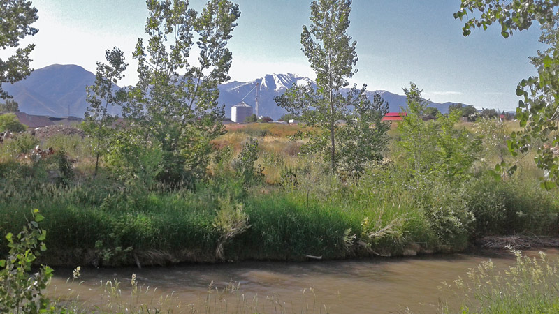
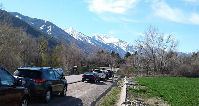
 Parking along 1100 East for the Middle Section Access    by Staff Photographer    Šutahbirds.org (2017)


 Old Growth Area, East of the Main St. Bridge    by Staff Photographer    Šutahbirds.org (2017)


                                                        Path Through Urban Forest Area    by Staff Photographer    Šutahbirds.org (2017)


                                                        Edge of Urban Forest Area    by Staff Photographer    Šutahbirds.org (2017)


  Trail Sign with Birds, Mammals and Plants    by Staff Photographer    Šutahbirds.org (2017)


Return to the Utah Birds Home Page