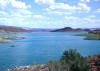
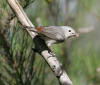
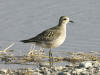
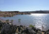
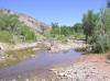
Ash Creek Reservoir
 Directions: Take
exit 36 of I-15 about 30 miles north of St. George or about 24 miles south
of Cedar City. The Reservoir is right next to the freeway. Directions: Take
exit 36 of I-15 about 30 miles north of St. George or about 24 miles south
of Cedar City. The Reservoir is right next to the freeway. |
|
Details |
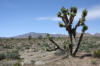
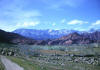
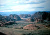
Beaver Dam Slope
Beaver Dam Wash
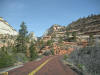
Coalpits Wash, Zion National Park
Directions: Go on UT 9 about 7.4 miles east of Virgin. Just before the bridge, take the dirt
road to the parking area by the road. This is the trailhead for Coalpits
Wash.
eBird Data: |
Coalpits Wash |
Grafton |
|
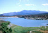
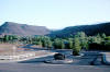
Enterprise Reservoirs
|
 Directions:
Go west of Enterprise on Main Street about 6 miles and bear left on the road
that follows Little Pine Creek (FR 006). Go 5 miles to the reservoir. Directions:
Go west of Enterprise on Main Street about 6 miles and bear left on the road
that follows Little Pine Creek (FR 006). Go 5 miles to the reservoir. |
|
Details |
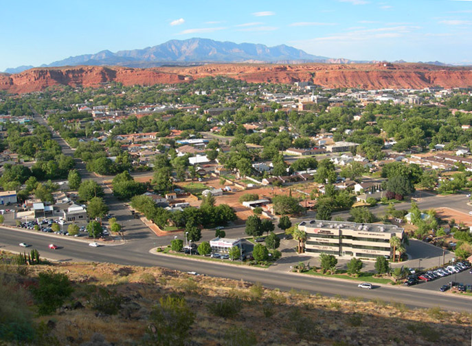
Forest Park ~
submitted by Josh Kreitzer
|
 Directions:
From I-15 southbound, take Exit 10 turn right then immediately left onto the
frontage road, look for Middleton drive and turn right. Follow it until 1800
East and turn right into the Forest Park parking lot. Directions:
From I-15 southbound, take Exit 10 turn right then immediately left onto the
frontage road, look for Middleton drive and turn right. Follow it until 1800
East and turn right into the Forest Park parking lot. |
|
Details |
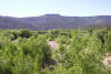
Grafton
 Directions: Go south from Rockville on Bridge Road about 3.8
miles. [Grafton is located about 3 miles west of Rockville just south of the
Virgin River]. Cross the bridge over the Virgin River and go right on Grafton
Road. Bear right at the next two junctions and proceed to the ghost town
of Grafton. (The riparian habit on the flood plane of the river is a good
birding place). Directions: Go south from Rockville on Bridge Road about 3.8
miles. [Grafton is located about 3 miles west of Rockville just south of the
Virgin River]. Cross the bridge over the Virgin River and go right on Grafton
Road. Bear right at the next two junctions and proceed to the ghost town
of Grafton. (The riparian habit on the flood plane of the river is a good
birding place). |
| Details |
Gunlock Reservoir
 Directions: Go west on UT 8 (Sunset Boulevard) from St. George
through Santa Clara to Shivwits. Take the road going right and go about 5
miles to the reservoir. Directions: Go west on UT 8 (Sunset Boulevard) from St. George
through Santa Clara to Shivwits. Take the road going right and go about 5
miles to the reservoir. |
|
Details |
Harrisburg
Ghost Town
 Directions:
Approaching from the South: Take exit 16 of
I-15 going east towards Harrisburg Junction and Zion Nat. Park. Go about a mile
and a half and turn left (north, going towards Leeds) on UT 212 (becomes Red
Cliff Road). Go about 4 miles and just past the road going to the
north end of Quail Creek Reservoir. Directions:
Approaching from the South: Take exit 16 of
I-15 going east towards Harrisburg Junction and Zion Nat. Park. Go about a mile
and a half and turn left (north, going towards Leeds) on UT 212 (becomes Red
Cliff Road). Go about 4 miles and just past the road going to the
north end of Quail Creek Reservoir. |
|
Details |
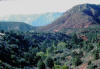
Hell Hole Pass Road
~ submitted by Oliver Hansen
 |
Directions: Head west on Sunset Blvd in St.
George passing through the town of Santa Clara. This road becomes Old HWY
91. You will enter the Shivwits Paiute Indian Reservation. Continue straight
at the intersection to Gunlock... |
|
Details |
Hurricane Fields
 Directions: From SR 9 in Hurricane, go south on 700 West for
about 2 miles, and turn right on 2060 South, follow this road past where it jogs
left for about 1.6 miles, and turn right for another 1.2 miles. The paved road
continues west around to
Sand Hollow State Park. Directions: From SR 9 in Hurricane, go south on 700 West for
about 2 miles, and turn right on 2060 South, follow this road past where it jogs
left for about 1.6 miles, and turn right for another 1.2 miles. The paved road
continues west around to
Sand Hollow State Park. |
|
Details |
Ivins Reservoir
~ submitted by Oliver Hansen
 |
Directions: Head west on Sunset Blvd in St.
George passing through the town of Santa Clara. This road becomes Old HWY
91. Shortly after mile marker 20 you will see the entrance to the Kayenta
Subdivision. About 4 tenths of a mile further you will see a small paved
road on the north side of the road... |
|
Details |
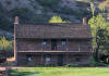
Jacob Hamblin Home
~ submitted by Marilyn Davis
 Directions:
From St. George take Hwy 91 west to Santa Clara. Take main road through
Santa Clara and just before the road curves right look for the historical
Jacob Hamblin Home sign, and turn right to parking area by hom Directions:
From St. George take Hwy 91 west to Santa Clara. Take main road through
Santa Clara and just before the road curves right look for the historical
Jacob Hamblin Home sign, and turn right to parking area by hom |
|
Details |
Kolob Reservoir
 Directions: Go east of La Verkin on UT 9 about 5 miles to
Kolob
Reservoir Road (in Virgin) and turn left. Go 23.5 miles to Kolob Reservoir. Directions: Go east of La Verkin on UT 9 about 5 miles to
Kolob
Reservoir Road (in Virgin) and turn left. Go 23.5 miles to Kolob Reservoir. |
| Details |
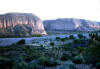
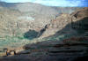
Lytle Ranch Preserve
(the
main access to Beaver Dam Wash)
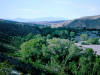 Description: Lytle Ranch (see Lytle Ranch Area Map)
is located in a section of the Mojave Desert that projects into Southwest Utah. This
island of trees and water in the middle of a very dry desert lies along a migratory
corridor, and creates an excellent stopping place for a great variety birds, many of
which, not usually found in other parts of Utah. Description: Lytle Ranch (see Lytle Ranch Area Map)
is located in a section of the Mojave Desert that projects into Southwest Utah. This
island of trees and water in the middle of a very dry desert lies along a migratory
corridor, and creates an excellent stopping place for a great variety birds, many of
which, not usually found in other parts of Utah. |
|
Details |
Mathis Park
|
 Description:
(See Mathis Park Page) Description:
(See Mathis Park Page) |
|
Details |
Oak Grove Campground
|
 Directions: Take Exit 23 of I-15 about 15 miles north of St.
George (just north of Leeds). Go west toward Silver Reef and enter the
Dixie National Forest. Go 8 miles to Oak Grove Campground. Directions: Take Exit 23 of I-15 about 15 miles north of St.
George (just north of Leeds). Go west toward Silver Reef and enter the
Dixie National Forest. Go 8 miles to Oak Grove Campground. |
|
Details |
Red Cliffs Campground
 Directions: Approaching from the South: Take exit 16 of I-15
going east towards Harrisburg Junction and Zion Nat. Park. Go about a mile and a
half and turn left (north, going towards Leeds) on UT 212 (becomes Red Cliff
Road). Go about 4 miles and just past the road going to the north
end of Quail Creek Reservoir, turn left and go through a very narrow underpass
of I-15 going east. Continue on that road less then 2 miles to the
campground. Directions: Approaching from the South: Take exit 16 of I-15
going east towards Harrisburg Junction and Zion Nat. Park. Go about a mile and a
half and turn left (north, going towards Leeds) on UT 212 (becomes Red Cliff
Road). Go about 4 miles and just past the road going to the north
end of Quail Creek Reservoir, turn left and go through a very narrow underpass
of I-15 going east. Continue on that road less then 2 miles to the
campground. |
|
Details |
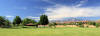
Red Hills Golf Course
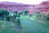 Directions:
Take UT 18 north, to the outskirts of St. George. The golf course is
on the right Directions:
Take UT 18 north, to the outskirts of St. George. The golf course is
on the right |
|
Details |
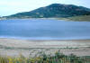
Sand Hollow Reservoir
(State Park)
 Directions:
While on I-15, take exit 16, towards Hurricane. Travel for four miles and
turn right at the light onto Turf Sod Road and follow the road south until
it curves to the east and the entrance to
Sand Hollow State Park. Follow the paved road to reach a
parking area, or turn
right onto a dirt road just past the entrance station that circles the south
and east sides. Directions:
While on I-15, take exit 16, towards Hurricane. Travel for four miles and
turn right at the light onto Turf Sod Road and follow the road south until
it curves to the east and the entrance to
Sand Hollow State Park. Follow the paved road to reach a
parking area, or turn
right onto a dirt road just past the entrance station that circles the south
and east sides. |
|
Details |
Seegmiller Pond (Springs
Pond)
Snow Canyon State Park
 Directions: Take UT 18 north of St. George a few miles to the
state park. Directions: Take UT 18 north of St. George a few miles to the
state park. |
|
Details |
Springdale Pond
Directions: From Zion Park Boulevard in Springdale (UT 9), turn
southeast on the road just north of the Zion Park Inn. Go down the hill to
the pond.
eBird Data: |
Springdale Pond |
Springdale -- Tanner
Amphitheater |
Grafton | Coalpits
Wash |
|
Springs Pond (Seegmiller
Pond)
Directions: Go east on St. George Boulevard in St. George going
under I-15. Turn right on River Road and turn left on 1450 South ("Stake
Farm Road") immediately after you cross the Virgin River. Go about a mile
and turn left toward Spring Estates. Springs Pond is located in a St.
George City Park, adjacent to the
Virgin River and Seegmiller Marsh.
eBird Data: |
Seegmiller Marsh Complex &
Springs Park Pond |
Washington Fields |
|
Tonaquint Park
|
 Directions: Go south on Bluff Street (UT 18) in St. George and
turn right on Hilton Drive just before you get to I-15. After you pass the
golf course bear right on Dixie Drive. Go a few hundred yards to the park
entrance. Directions: Go south on Bluff Street (UT 18) in St. George and
turn right on Hilton Drive just before you get to I-15. After you pass the
golf course bear right on Dixie Drive. Go a few hundred yards to the park
entrance. |
| Details |
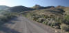
Upper Sand Cove Reservoir
Directions: Upper Sand Cove Reservoir is northwest of St. George, near the town of Veyo, a mile or two west of SR-18. Heading north on SR-18 from St. George, the dirt road turnoff to Upper Sand Cove Reservoir is on the left (west) after
passing the Dameron Valley community and before reaching the Veyo Cinder Cone (large basalt cinder hill on the west side of SR-18). If you reach the small town of Veyo you've gone too far.
~ Rick Fridell
eBird Data: |
Upper Sand Cove Reservoir
|
|
Utah Hill
|
 Directions:
This is a place you'd usually drop by on the way to
Lytle Ranch. (Click on "details" for directions to this location). Directions:
This is a place you'd usually drop by on the way to
Lytle Ranch. (Click on "details" for directions to this location). |
|
Details |
Virgin River/LaVerkin Creek
Confluence
|
 Directions:
Take the SR-9 exit of I-15 and go through Hurricane and LaVerkin. After the
second light in LaVerkin proceed
straight down the hill as if going towards Toquerville. Just before the LaVerkin
Creek bridge at the bottom of the hill, turn left into a residential area.
Continue on this road as it runs parallel to the creek, becomes a dirt road
and ending at a small parking lot at the beginning of the confluence trail. Directions:
Take the SR-9 exit of I-15 and go through Hurricane and LaVerkin. After the
second light in LaVerkin proceed
straight down the hill as if going towards Toquerville. Just before the LaVerkin
Creek bridge at the bottom of the hill, turn left into a residential area.
Continue on this road as it runs parallel to the creek, becomes a dirt road
and ending at a small parking lot at the beginning of the confluence trail. |
|
Details |
Virgin River Parkway
Directions: 1. North end: Take Exit 6 (I-15) in St. George
going south (Riverside Drive/ Bluff Street). Go right on Main Street and
go to the end of the road to the trailhead.
2. South end: Take Exit 4 (I-15) in Bloomington and go south
on Pioneer Road. Go west on Man O'War Drive crossing the Virgin River to the
parking area and trailhead on the other side.
eBird Data: |
Virgin River Trail |
-- Riverside Trailhead
| Boots Cox Park |
Riverside Marsh |
|
Washington Area
Directions: About 4 miles northeast of St. George on I-15.
eBird Data: |
Washington City Cemetery |
Green Springs Golf Course
| Sullivan Virgin River Park
|
|
Washington Fields
|
 Directions: Go east on St. George Boulevard in St. George going
under I-15. Turn right on River Road and turn left on 1450 South
("Stake Farm Road") immediately after you cross the Virgin
River. Go about 2 miles and turn left on 3000 East and Washington Fields. Directions: Go east on St. George Boulevard in St. George going
under I-15. Turn right on River Road and turn left on 1450 South
("Stake Farm Road") immediately after you cross the Virgin
River. Go about 2 miles and turn left on 3000 East and Washington Fields. |
|
Details |
Welcome Spring
 Directions:
This is a place you'd usually drop by on the way to
Lytle Ranch. (Click on "details" for directions to this location). Directions:
This is a place you'd usually drop by on the way to
Lytle Ranch. (Click on "details" for directions to this location). |
|
Details |
|