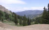
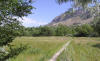
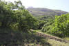
Popular Birding Places
Weber County
|
 |
|
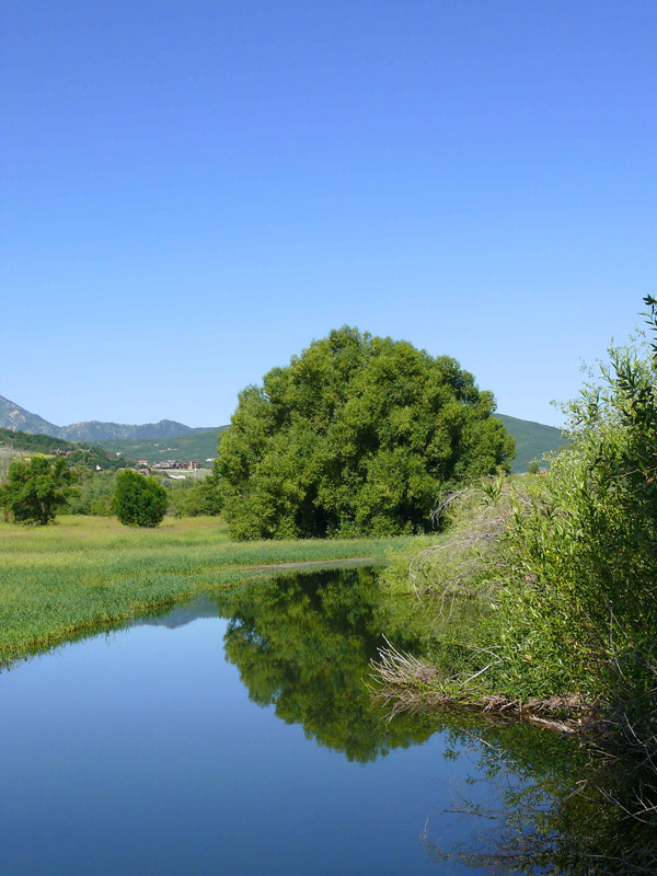
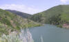
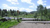
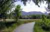
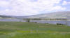
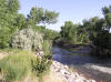
Ogden Valley by Keith Evans
©Keith Evans
|
Anderson Cove Campground
|
 Directions:
Anderson Cove Campground is located at mile 17.5 of SR-39. [in Ogden Canyon near
Huntsville] Directions:
Anderson Cove Campground is located at mile 17.5 of SR-39. [in Ogden Canyon near
Huntsville]
|
|
Details |
Beus Canyon
|
 Directions:
Go east on 4600 South in Ogden until the road cures south, then look for the
sign on the left side of the road near the microwave towers. Directions:
Go east on 4600 South in Ogden until the road cures south, then look for the
sign on the left side of the road near the microwave towers.
|
|
Details |
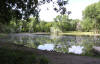
Beus Park and Beus Pond,
in Ogden
|
 Directions:
(directions from the north, south and east are available in the
"Details.") Directions:
(directions from the north, south and east are available in the
"Details.")
|
|
Details |
Causey Reservoir
|
 Directions:
Causey Reservoir is located off SR-39 about 10 miles east of Ogden Valley.
Within mile 27 of SR-39, turn east on Causey Road at Red Rock Ranch and
Outfitters and drive until the road ends at the reservoir. Directions:
Causey Reservoir is located off SR-39 about 10 miles east of Ogden Valley.
Within mile 27 of SR-39, turn east on Causey Road at Red Rock Ranch and
Outfitters and drive until the road ends at the reservoir.
|
|
Details |
Dairy Ridge and Eli Ridge Road
(actually in Rich County)
|
 Directions: Dairy Ridge and Eli Ridge Road are located on UT 39 between
mile markers 45 and 46. To get there from I-15, exit the interstate at
344 and turn east on 12th Street, also named UT 39. Follow UT 39 through Ogden
Canyon, along the south shore of Pineview Reservoir, and east of Huntsville. UT
39 proceeds due east of Huntsville and follows the South Fork of the Ogden
River... Directions: Dairy Ridge and Eli Ridge Road are located on UT 39 between
mile markers 45 and 46. To get there from I-15, exit the interstate at
344 and turn east on 12th Street, also named UT 39. Follow UT 39 through Ogden
Canyon, along the south shore of Pineview Reservoir, and east of Huntsville. UT
39 proceeds due east of Huntsville and follows the South Fork of the Ogden
River...
|
|
Details |
Fort Buenaventura
|
 Directions: From 1-15 exit 342 (24th Street in Ogden) turn east. Drive one mile on
24th Street and turn south on A Street. Follow the brown signs to Raptor
Field/Fort Buenaventura; it's less than a block from 24th Street. Pass Raptor
field and continue south. Directions: From 1-15 exit 342 (24th Street in Ogden) turn east. Drive one mile on
24th Street and turn south on A Street. Follow the brown signs to Raptor
Field/Fort Buenaventura; it's less than a block from 24th Street. Pass Raptor
field and continue south.
|
|
Details |
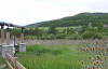
Harold Crane WMA
|
 Directions
from the South: Take the 12th Street exit (exit 344)
of I-15 in the Ogden area and go west on Highway 39 to 6700 West and turn
right (north). Go 3 mile or so to the end of the road and you will be at
the wetlands. Directions
from the South: Take the 12th Street exit (exit 344)
of I-15 in the Ogden area and go west on Highway 39 to 6700 West and turn
right (north). Go 3 mile or so to the end of the road and you will be at
the wetlands.
|
|
Details |
Maples Loop Nordic Trail
(Snowbasin)
|
Directions: Snowbasin is accessed from SR-167, south Huntsville. Maples Loop Nordic Trail
starts from the northernmost Snowbasin parking lot (#3 at the corner farthest from
the entrance to the parking lot.
|
|
Details |
Middle Fork WMA
|
 Directions: From
SR-39 on the east side of
Huntsville go
north to where SR-39 turns east toward Monte Cristo, but continue straight
for about 1/4 of a mile then bear right onto 7800 East. Continue on 7800 East to
1900 North where you will see the entrance sign. Directions: From
SR-39 on the east side of
Huntsville go
north to where SR-39 turns east toward Monte Cristo, but continue straight
for about 1/4 of a mile then bear right onto 7800 East. Continue on 7800 East to
1900 North where you will see the entrance sign.
|
|
Details |
The North Arm Natural
Area of Pineview
Reservoir
|
 Directions: From I-15 exit 344, turn east on SR-39 and drive through
Ogden Canyon. At the head of the canyon, turn left (north) onto SR-158 and over
Pineview Dam. Drive 3.8 miles and turn right into the trailhead parking lot. Directions: From I-15 exit 344, turn east on SR-39 and drive through
Ogden Canyon. At the head of the canyon, turn left (north) onto SR-158 and over
Pineview Dam. Drive 3.8 miles and turn right into the trailhead parking lot.
|
|
Details |
Ogden
Cemetery
|
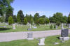 Directions: The cemetery is located on 20th Street between 450
E. and 700 E. streets in Ogden. You can park on 20th Street and walk into
the cemetery from there. Directions: The cemetery is located on 20th Street between 450
E. and 700 E. streets in Ogden. You can park on 20th Street and walk into
the cemetery from there.
|
|
Details |
Ogden Nature Center
|
Directions: Take the 12th Street exit (Exit 344) and go east
toward Ogden. Go about 1.5 miles to the nature center on the left side of
the road.
|
|
Details |
Ogden River Parkway
|
 Directions: Take the 12th Street exit (Exit 344) in Ogden and go
east through Ogden toward Ogden Canyon. Turn right at the sign for
"Dinosaur Park" about 100 yards before entering Ogden Canyon and cross
the river to the parkway head. Directions: Take the 12th Street exit (Exit 344) in Ogden and go
east through Ogden toward Ogden Canyon. Turn right at the sign for
"Dinosaur Park" about 100 yards before entering Ogden Canyon and cross
the river to the parkway head.
|
|
Details |
Ogden Bay Waterfowl Management Area
|
 Directions: North Entrance: Go west on 12th Street (becomes 900 South) in Ogden
to 7500 West. Turn south and proceed to the north entrance. Or, from
Hooper, go west to 7500 West. Turn north and proceed to the south
entrance. Directions: North Entrance: Go west on 12th Street (becomes 900 South) in Ogden
to 7500 West. Turn south and proceed to the north entrance. Or, from
Hooper, go west to 7500 West. Turn north and proceed to the south
entrance.
South Entrance: "To reach Ogden Bay's south entrance...
|
|
Details |
Perception Park
|
 Directions: From exit 344 of I-15, go east
on 12th Street, also named UT 39. Follow UT 39 through Ogden Canyon, along
the south shore of Pineview Reservoir, and east of Huntsville. UT 39 will
proceed due east of Huntsville and follow the South Fork of the Ogden
River. Watch the mile markers. Perception Park is located between mile
markers 26 and 27 on UT 39. Directions: From exit 344 of I-15, go east
on 12th Street, also named UT 39. Follow UT 39 through Ogden Canyon, along
the south shore of Pineview Reservoir, and east of Huntsville. UT 39 will
proceed due east of Huntsville and follow the South Fork of the Ogden
River. Watch the mile markers. Perception Park is located between mile
markers 26 and 27 on UT 39.
|
|
Details |
Pineview Reservoir
|
 Directions: Directions:
Take 12th Street in Ogden east up Ogden Canyon (UT 39) to the dam and Pineview
Reservoir. Directions: Directions:
Take 12th Street in Ogden east up Ogden Canyon (UT 39) to the dam and Pineview
Reservoir.
|
|
Details |
Powder Mountain Ski Area,
Powder Ridge Village Condominiums
|
 Directions: From
I-15 exit 344, turn east onto SR-39 and drive through Ogden Canyon. At the head
of the canyon, turn left (north) onto SR-158. The highway ends nearly 12 miles
later at the main base lodge of Powder Mountain Ski Area... Directions: From
I-15 exit 344, turn east onto SR-39 and drive through Ogden Canyon. At the head
of the canyon, turn left (north) onto SR-158. The highway ends nearly 12 miles
later at the main base lodge of Powder Mountain Ski Area...
|
|
Details |
Rainbow and Steward/Birdsong
Trails (submitted by Kristin Purdy)
|
 Directions: Take I-15 to exit 344, 12th Street/SR-39. Turn east toward the
mountains. Just before Ogden Canyon, turn right on Valley Drive and immediately
left into the Rainbow Gardens Gift Shop parking lot. The trailheads that serve
both trails is located in the far right (southwest) corner of the parking lot. Directions: Take I-15 to exit 344, 12th Street/SR-39. Turn east toward the
mountains. Just before Ogden Canyon, turn right on Valley Drive and immediately
left into the Rainbow Gardens Gift Shop parking lot. The trailheads that serve
both trails is located in the far right (southwest) corner of the parking lot.
|
|
Details |
Riverdale Parkway
(see Weber River Trail)
|
Steward Birdsong Trail
(see Rainbow and Steward/Birdsong Trails)
|
Strong Canyon
(36th Street Trailhead)
|
 Directions: The
trailhead is located at the east end of 36th Street in Ogden, just before the
road turns south. Directions: The
trailhead is located at the east end of 36th Street in Ogden, just before the
road turns south.
|
|
Details |
Weber River Trail
(Riverdale Parkway)
~ submitted by Kristin Purdy
|
 Directions: Take I-15 to exit 339, Riverdale. Turn east on Riverdale Road
and drive 1.3 miles to 700W. Turn left (north). Drive a block to 4400S and turn
right (east). Continue east on 4400S as the road curves north and dead-ends at a
trailhead. Directions: Take I-15 to exit 339, Riverdale. Turn east on Riverdale Road
and drive 1.3 miles to 700W. Turn left (north). Drive a block to 4400S and turn
right (east). Continue east on 4400S as the road curves north and dead-ends at a
trailhead.
|
|
Details |
Wheeler Creek / Canyon
|
 Directions: Take
exit 347 (Ogden, 12th Street) of I-15, and go east 9.5 miles through Ogden
Canyon. Just before you reach the Pineview Reservoir dam, turn right into
the Wheeler Creek trailhead parking lot. Directions: Take
exit 347 (Ogden, 12th Street) of I-15, and go east 9.5 miles through Ogden
Canyon. Just before you reach the Pineview Reservoir dam, turn right into
the Wheeler Creek trailhead parking lot.
|
|
Details |
Wolf Canyon Trail
~ submitted by Kristin Purdy
|
 Directions: Take
I-15 to exit 344 (12th St. and UT 39) and turn east. Pass through Ogden Canyon
and turn right onto UT 158 at Pineview Dam. Watch your odometer; the trailhead
is located on the west side of the road [to Powder Mountain] behind the white gate at mile 8.2. Directions: Take
I-15 to exit 344 (12th St. and UT 39) and turn east. Pass through Ogden Canyon
and turn right onto UT 158 at Pineview Dam. Watch your odometer; the trailhead
is located on the west side of the road [to Powder Mountain] behind the white gate at mile 8.2.
|
|
Details |

|