|
Popular Birding Places |
 |
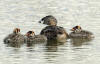
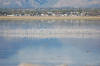
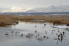
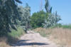
| On the Way to Antelope Island
by Carol Gwynn
©Carol Gwynn |
|
|
|
|
 Directions: Take the Syracuse exit of I-15 (Exit 332) and go west 7
miles on UT 108 to
the Antelope Island State Park fee booth (at the beginning of the causeway). The
six-mile-long causeway leads to the island with the park visitor center on the
north end and Garr Ranch 13 miles south on the east shore. -
see Antelope
Island Causeway - see Garr Ranch Directions: Take the Syracuse exit of I-15 (Exit 332) and go west 7
miles on UT 108 to
the Antelope Island State Park fee booth (at the beginning of the causeway). The
six-mile-long causeway leads to the island with the park visitor center on the
north end and Garr Ranch 13 miles south on the east shore. -
see Antelope
Island Causeway - see Garr Ranch |
| Details |
|
|
 Directions: Take the Syracuse exit of I-15 (Exit 332) and go west 7 miles on UT
108. Directions: Take the Syracuse exit of I-15 (Exit 332) and go west 7 miles on UT
108. |
| Details |
|
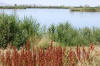
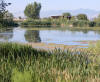
Bountiful Lake (submitted by Paul Lombardi) |
 Directions: To get to the lake, take the 500 S. exit off the
Legacy Parkway and drive north on the frontage road (west side of the parkway)
just past the sewage treatment plant. Directions: To get to the lake, take the 500 S. exit off the
Legacy Parkway and drive north on the frontage road (west side of the parkway)
just past the sewage treatment plant. |
| Details |
|
|
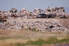 Directions: Go north on 1100 West from 500 South (there's an
exit off I-15 at 500 South - 1100 West is west of the freeway) to the stop sign
at 1600 North. Turn left on 1600 North and follow the road around to the
landfill entrance. Directions: Go north on 1100 West from 500 South (there's an
exit off I-15 at 500 South - 1100 West is west of the freeway) to the stop sign
at 1600 North. Turn left on 1600 North and follow the road around to the
landfill entrance. |
| Details |
|
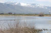
Buffalo Ranch (Pond
and Trail) |
 Directions:
From I-15, take exit 324 (northbound) or 325 (southbound) for Park Lane.
Turn west onto Park Lane and drive to the
traffic light at Clark
Lane. Turn west onto Clark Lane, drive west through the subdivision called
Farmington Ranches, and
park across the street (south) from the very obvious red buildings of the
Buffalo Ranch complex... Directions:
From I-15, take exit 324 (northbound) or 325 (southbound) for Park Lane.
Turn west onto Park Lane and drive to the
traffic light at Clark
Lane. Turn west onto Clark Lane, drive west through the subdivision called
Farmington Ranches, and
park across the street (south) from the very obvious red buildings of the
Buffalo Ranch complex... |
| Details |
|
|
 Directions: Take Exit 319 in Centerville going east and turn left onto
the frontage road (Market Place Drive). Go 3 miles and turn left on
Glover's Lane (925 South). Go 1.4 miles and turn left onto 1325 West Street which
leads to the the management area. (more info) Directions: Take Exit 319 in Centerville going east and turn left onto
the frontage road (Market Place Drive). Go 3 miles and turn left on
Glover's Lane (925 South). Go 1.4 miles and turn left onto 1325 West Street which
leads to the the management area. (more info) |
| Details |
|
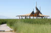
Garr Ranch
(Fielding Garr Ranch) |
 Directions: Take the Syracuse exit of I-15 (Exit 332) and go west 7
miles on UT 108 to
the Antelope Island State Park fee booth (at the beginning of the causeway).
Continue along the causeway 6 miles to the island and take the left fork of the
road. In less than a half mile turn left and travel along this road about
13 miles to the ranch. Directions: Take the Syracuse exit of I-15 (Exit 332) and go west 7
miles on UT 108 to
the Antelope Island State Park fee booth (at the beginning of the causeway).
Continue along the causeway 6 miles to the island and take the left fork of the
road. In less than a half mile turn left and travel along this road about
13 miles to the ranch. |
| Details |
|
Glover's Lane Ponds (at west end of Glovers's Lane) |
 Directions: Take Exit 319 in Centerville going east and turn left onto
the frontage road (Market Place Drive). Go 3 miles and turn left on
Glover's Lane. Go several miles west until the road ends near the ponds
and radar tower. Directions: Take Exit 319 in Centerville going east and turn left onto
the frontage road (Market Place Drive). Go 3 miles and turn left on
Glover's Lane. Go several miles west until the road ends near the ponds
and radar tower. |
| Details |
|
|
 Directions: Take
Exit 330 in Layton going east. Turn on Gentile Street and go west
about 6 miles. Before you get to three radio towers, bear right
following the pavement which becomes Bluff Road. Continue west to
about 0.1 miles past the last tower where the entrance to the preserve is on
the left Directions: Take
Exit 330 in Layton going east. Turn on Gentile Street and go west
about 6 miles. Before you get to three radio towers, bear right
following the pavement which becomes Bluff Road. Continue west to
about 0.1 miles past the last tower where the entrance to the preserve is on
the left |
| Details |
|
Howard Slough WMA |
 Directions: Take Exit 335 in Layton and go west on UT 107 (300
North). Go through West Point and continue to 4500 West (UT 110).
Turn left (south) and go about 1/2 mile and turn right (west) on the road that
goes around Howard Slough. Directions: Take Exit 335 in Layton and go west on UT 107 (300
North). Go through West Point and continue to 4500 West (UT 110).
Turn left (south) and go about 1/2 mile and turn right (west) on the road that
goes around Howard Slough. |
| Details |
|
Jensen Nature Park ~ submitted by Kristin Purdy |
|
|
| Details |
|
Kayscreek
Parkway ~ submitted by Kristin Purdy |
|
|
| Details |
|
|
 Directions:
From I-15 take Exit #328 Kaysville. Go East (200 North) to Main Street (5
blocks). Turn right on Main Street (South) and go 3 blocks to 50 West. Turn
right onto 50 West and go 8 blocks (South) to 550 South. The ponds are on
the right (West of 50 West). Directions:
From I-15 take Exit #328 Kaysville. Go East (200 North) to Main Street (5
blocks). Turn right on Main Street (South) and go 3 blocks to 50 West. Turn
right onto 50 West and go 8 blocks (South) to 550 South. The ponds are on
the right (West of 50 West). |
| Details |
|
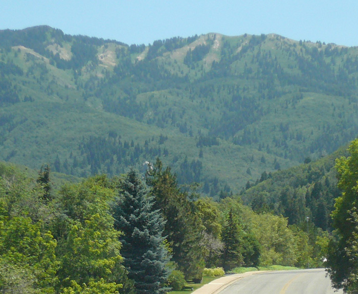
Layton Marsh Wetlands Preserve (Great Salt Lake Shorelands Preserve) |
|
|
 Directions: Take Exit 315 of I-15 (Bountiful Woods Cross Exit)
going east. After a couple of blocks turn left going north on UT 89 (the main
road) and go 8 blocks to 1875 South and turn right (going east). after a couple
of miles the road will bend to the southeast and will become Mueller Park Road.
The park is about 1 ½ miles past that bend. Directions: Take Exit 315 of I-15 (Bountiful Woods Cross Exit)
going east. After a couple of blocks turn left going north on UT 89 (the main
road) and go 8 blocks to 1875 South and turn right (going east). after a couple
of miles the road will bend to the southeast and will become Mueller Park Road.
The park is about 1 ½ miles past that bend. |
| Details |
|
|
|
|
 Directions: Located at 200 East and 300 South in Farmington. Directions: Located at 200 East and 300 South in Farmington. |
| Details |
|
|