(To print a county map along with this information,
go to the Print
Center)
Chalk Creek [Utah
Birding Trails]
Directions: From Main Street in Fillmore, go east on 200
South (Canyon Road) about 2.5 miles. Take Forest road 100 and go about four
miles to Pistol Rock Picnic Area.
Birds: Steller's Jay, Townsend's Solitaire, Mountain Chickadee,
Green-tailed Towhee, Sage Thrasher, Black-throated Gray Warbler, Western
Tanager, Brewer's Sparrow, Vesper Sparrow, Lark Sparrows.
eBird Data: |
Holden Cemetery |
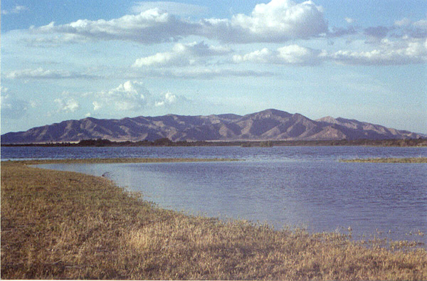
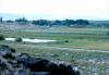
Clear Lake Wildlife Management Area
 |
Directions: Go about 10 miles south of Delta on UT 257 and turn
left (east) onto a graded dirt road. The Clear Lake WMA is about 6 miles
up the road. |
|
Details |
Fool Creek Reservoir
 |
Directions: Fool Creek Reservoir is about 5 miles southeast of
Lynndyl. There's a dirt road that goes west from UT 125 about 3 1/2 miles
north of Oak City or 10 miles south of Leamington. Go about 2 1/2
miles along this road to the reservoir. |
|
Details |
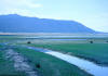
Gunnison Bend Reservoir
 |
Directions: Gunnison Bend Reservoir lies about a mile directly west
of Delta.
From Delta: Take US 6/50 going west out
of Delta (the main street). After the road curves towards the southwest
(just out of town), go about a mile and turn right. After about a half
mile, turn right again on 2000 West Street and go about a half mile to the
reservoir.
From Hinckley: Take US 6/50 going east out of
Hinckley. After a little less than four miles, turn left on 2000 West
Street and go about a mile to the reservoir. |
|
Details |
Kaufman Ranch
(private)
 |
Directions: Kaufman Ranch is located at Black Rock,
about 21 miles north of Milford on SR 257. Be sure stop at the house to request permission
to bird the property. |
|
Details |
Maple Grove Campground
 |
Directions: Turn west from US 50 16 miles south of Scipio (14
miles northwest of Salina) and go 4 miles on the main road to the campground. |
|
Details |
Pruess Lake
Directions: The reservoir is just south of Garrison
[about 3 miles], along SR 21. You can get there by taking SR 21 west from
Milford, or by going west on US 6 from Delta, and taking SR 21 south from the
Utah/Nevada border. ~ Mark Stackhouse
eBird Data: |
Pruess Reservoir |
Clay Spring & Marshes |
Garrison |
Scipio Lake
 |
Directions: Scipio Lake lies just west of US 50, 10 miles south of
Scipio or 18 miles northwest of Salina. |
|
Details |
Sinks Road
(Sink Road)
Directions: 1. The Sink Road runs from Lynndyl to UT 125 (Between
Leamington and Oak City).
2. The "sinks" road is a gravel road
between US 6 and SR 125 about 2 miles north of Oak City
eBird Data: |
Lynndyl -- Sevier River Oxbow
Lake | Leamington --
Hwy 132 & Tamarix Rd |
Wah Wah Ranch
Directions: Take State Highway 21 west from Milford about 25 miles.
The Wah Wah Ranch
is about 1/2 mile north of the highway, and the only spot of green in the valley.
eBird Data: |
Wah Wah Mountains |

|