Popular Birding Places
   Grand County

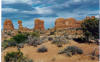
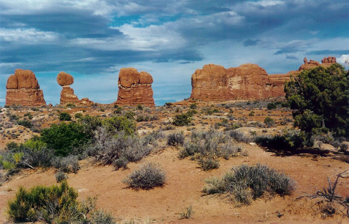
Arches National Park    by George Lyman    August 2002 ©George Lyman
  

(To print a county map along with this information, go to the Print Center)

 Arches National Park

Directions: Arches National Park is located 5 miles north of Moab on US 191.

 Details


Colorado River Scenic Byway   [Utah Birding Trails]

     eBird Data:   |  Scenic Byway 128Dolores River  -- Just upstream of confluenceRio Mesa Center |


Courthouse Wash

Directions:  From the entrance of Arches National Park 5 miles north of Moab on US 191, go 4 miles on the park road to Courthouse Wash.

     eBird Data:   |  Courthouse Wash Pond |


 Dead Horse Point State Park

Directions: Go north from Moab about 9 miles and turn west on UT 313.  Go 23 miles to the park.

 Details


Fisher Mesa   [Utah Birding Trails]

     eBird Data:   |  Fisher Towers Picnic Area |


Green River Area   [Utah Birding Trails]

     eBird Data:   ( see Emery County )


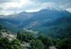
LaSal Mountain Loop Road   [Utah Birding Trails]

     eBird Data:   |  La Sal Mountains -- Castleton RdLa Sal Mountain Loop |
                            |  La Sal Mountain Loop (San Juan Co.) |  La Sal Mountains -- Geyser Pass (San Juan Co.) |
                            |  La Sal Mountains -- Dark Canyon (San Juan Co.) |


Sago Canyon   [Utah Birding Trails]

     eBird Data:   |  I-70 -- Cresent Junction Rest Stop |


Moab

     eBird Data:   |  MoabMill Creek Parkway West of US 191Mill Creek Walkway East of US 191 |


Moon Flower Canyon   [Utah Birding Trails]

     eBird Data:   |  Moonflower CanyonKane Creek Blvd -- Adjacent to Colorado River |


 Mill Creek

Directions: From Main Street in Moab, turn east on Center St. and go to 400 East. Turn right (south) and go about 4 blocks and turn left (east) on Mill Creek Drive.  Go about 5 blocks and turn right (south) on So. Mill Creek Drive and go about 5 block and turn left on Powerhouse Lane.  Go about 4 blocks to the end of the road and park.

 Details


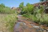
Negro Bill Canyon   [Utah Birding Trails]

     eBird Data:   |  Negro Bill Canyon Trail


 Scott M. Matheson Preserve

Directions: 1. Middle entrance:  Go west from Moab on 400 North until it end.
   2. South entrance: Go west off Main Street in Moab on Kane Creek Boulevard for 0.7 miles to a fork in the road.  Go to the left on Kane Creek Road for 0.7 miles to the south entrance.

 Details


 Warner Lake

Directions: Go south on US 191 from Moab about 8 miles and turn east on the road to Ken's Lake and the La Sal Mountain Loop Road.   Go about 15 miles and turn right on the Warner Lake road.  Go about 5 miles to the lake.

Details


Westwater   [Utah Birding Trails]

     eBird Data:  |Westwater Boat Launch |


Return to the Utah Birds Home Page