|
|
||||||||||||||||||||||
|
|
||||||||||||||||||||||
      |
||||||||||||||||||||||
|
||||||||||||||||||||||
Birding in Garfield County

Population: 5,051 (2018)
Area: 5,175 sq. miles
County Seat: Panguitch
County Web Site: (click)
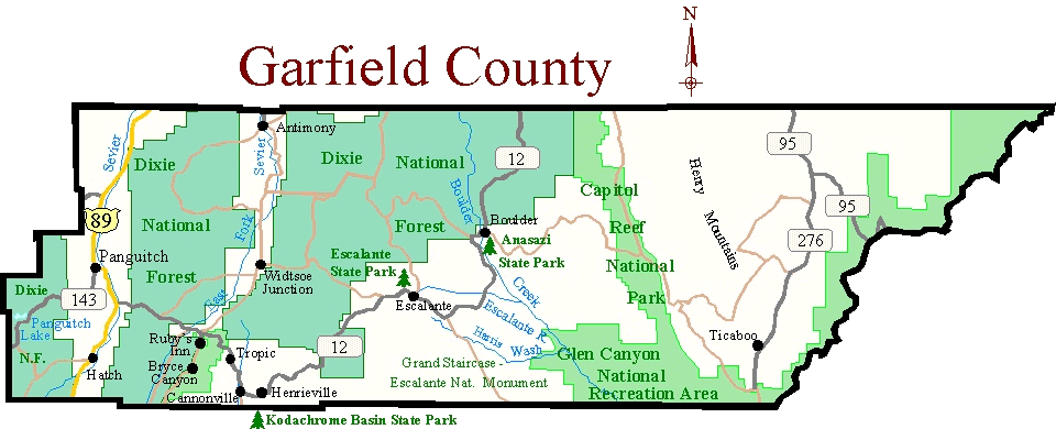
County Map
Print Map and Information
County Checklist (PDF)
Other Checklists
eBird Data
(Click Map or thumbnails to enlarge)
Popular Birding Places (Alphabetical List)
Along Highway 12 Bryce Canyon Area
- Calf Creek Falls Trail
- Calf Creek Recreation Area
- Cottonwood Canyon (Kane Co.)
- Escalante State Park
- Harris Wash
- Highway 12 (Wayne & Garfield Cos.)
- Kodachrome Basin SP (Kane Co.)
- Wide Hollow Reservoir
- Bryce Canyon National Park
Checklist: Web | Printable- Panguitch Lake
- Tropic Reservoir
East - Henry Mountain Area
eBird Data for Garfield County
- Recent Rare Bird Sightings (Sighting of rare birds reported in the last week)
- Bar Chart for all Species (Click on "MAP" to see the individual sightings)
- Last Sightings for all species (You can change the options to "First sightings" or "High Counts")
Bird Sightings
- Recent Sightings in Garfield County (From "Hotline Highlights" reports)
- Rare Birds Seen in Garfield County (From Utah Bird Records Committee sightings)
Listing Records
Garfield County Listing Records (Life lists, "Big" lists, etc.)
Checklists
National Parks, Monuments, and Recreation Areas
- Bryce Canyon Nat. Park National Park Service | American Park Network | GORP | Go Utah |
- Glen Canyon National Recreation Area National Park Service | (Lake Powel) Go Utah |
- Grand Staircase - Escalante National Monument BLM | GORP | Go Utah |
National Lands
State Parks
- Anasazi, Boulder | Parks & Rec. |
- Escalante, Escalante | Parks & Rec. |
- Kodachrome Basin, Cannonville | Parks & Rec. |Go Utah |