Popular Birding Places
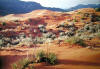
Kane County
  

Coral Pink Sand Dunes, on a Morning after a Rain  by Merrill Webb   ©Merrill Webb
  

(To print a county map along with this information, go to the Print Center)


Alton Ponds [McDonald Lake, Le Vanger Lakes]

Directions: From US 89 about 6 miles south of the junction with UT 14 (Long Valley Junction) go east on CR 10.  Along the 4 mile road to Alton there are three lakes, the first is McDonald Lake and the next two are Le Vanger Lakes.

Details


Coral Pink Sand Dunes  (Yellowjacket Canyon Road)

Directions: From US 89 about two miles southeast of Mount Carmel Junction take Sand Dunes Road heading in a southwest direction. Coral Pink Sand Dunes State Park is about 12 miles down the road.

Details


Cottonwood Canyon

Directions: 1. Southern approach: Go 32 miles east of Kanab (18 miles from the Arizona border) on US 89 and turn left (north).  From the Paria Ranger Station, it is 3 miles to the Cottonwood Canyon road..  The Cottonwood Canyon road goes 46 miles to Cannonville.
   2. Northern approach:  Go south from Cannonville on Cottonwood Canyon road.
[There's another Cottonwood Canyon in Kane County.  The other one is east of Kanab by the Vermilion Cliffs].

Details

Duck Creek Reservoir

Directions:  Go 25 miles east of Cedar City on UT 14.

     eBird Data:   |  Duck Creek VillageNavajo LakeCedar Breaks NM (Iron Co.) |


Lake Powell

Directions:  Go south on Hwy 89 to the Utah-Arizona border.  The east end of Like Powell can be accessed by boat or from UT 95 coming south from Hanksville go to Hite and connecting with UT 276 going to Bullfrog.

     eBird Data:  |  Lake Powell -- Wahweap Bay-- Lone Rock Beach | -- Last Chance Bay |
          (east end)  |  Bullfrog -- Marina-- Campground | -- Visitor Center and Clinic |
                           |  Lake Powell -- Good Hope Bay | -- Hite Overlook (Garfield Co.) | -- Hite (San Juan Co.) |
    (Arizona side)  |  Glen Canyon NRA -- Wahweap-- Lake Shore Dr-- Antelope Point Marina
                           |  Glen Canyon Dam overlook | Page WTP  |


Glendale - Grand Staircase - Escalante National Monument Rest Area
Directions: Glendale is about 10 miles north of Mount Carmel Junction on US 89.
         Details

Hancock Road

Directions: From US 89 about 8 miles north of Kanab turn west on Hancock Road which courses southwestward to Ponderosa Grove Campground and Coral Pink Sand Dunes about 5 miles down the road.  
         Details

Kanab Creek

Directions:  Go south of Kanab 0.4 miles on UT 11 / US Alt. 89.  Turn right on the road to Kanab Creek Ranchos subdivision.  Follow Kanab Creek Drive about 0.6 miles to the creek.


Kanab Water Treatment Ponds  submitted by Carol Nelson

Directions: Follow Highway 89 to Kanab City's 300 south intersection.  (Turning east this intersection leads to Lake Powell.) You will do the opposite and turn west at the intersection.  Follow 300 south to its end.  It will drop down through a wash and come up again.  On the other side of the wash 300 south turns into S. Powell Street.  Follow Powell through at least 3 stop signs and continue to its end.  The ponds are at the end of S. Powell.

Details


Kodachrome Basin State Park

Directions: Go south from Cannonville on Cottonwood Canyon road for about 7 miles and turn left on a road (a little over two miles long) going north into Kodachrome Basin.

        Details

Ponderosa Grove Campground
Directions: From US 89 about 8 miles north of Kanab turn west on Hancock Road which courses southwest.  Go about 5 miles (birding on the way -- this is a good birding area) to the campground. 
        Details

Three Lakes Canyon

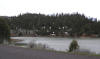
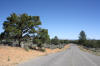
Directions: This Canyon lies between Mount Carmel on the north and Kanab on the south along US 89.

     eBird Data:   |  Mt. Carmel JunctionMt. Carmel WTP  |  Mt. Carmel Cemetery |
                            |  Angel Canyon Rd -- near Best Friends Animal Society |

Nearby: Hancock Road,


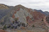
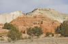
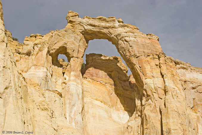
Grand Staircase  - Grosvenor Arch    by Brian Currie   ©Brian L. Currie


Return to the Utah Birds Home Page