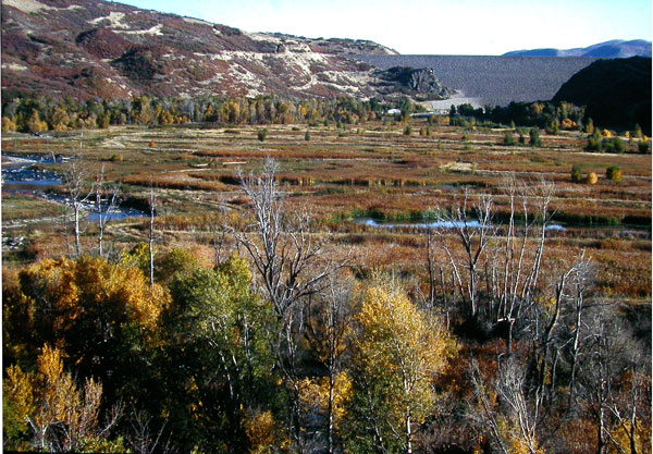
Directions: Go north of Heber on US
40 about 2 miles and turn right (at the stop light) on UT 32. Go 0.4 miles and turn left onto the road going toward the Jordanelle
Dam.
(1) to the PRRP (South): Go 1.1 miles and turn left on the dirt road,
which goes a couple hundred feet to a parking lot with a restroom. From here the
south end of the wetlands boardwalk/trail can be accessed, as well as the dirt
road that parallels the river.
(2) to the Westlands (North): Proceed to the end of
the road to a parking lot just past an RV park. There is a dirt road that goes along the river and connects
with the Provo River Restoration Project
tails and parking lot a mile or so downstream. There is also a trail that
takes off from the south side of the buildings just across the road from the
parking lot and proceeds south, parallel to the river. There are trees on the
west side of this trail and fields and wetlands on the east side.
Specialty Birds: Gray Catbird, Willow Flycatcher, American
Dipper, Belted Kingfisher Cedar Waxwing, Swainson's Thrush, (Rarities)
Least Flycatcher, American Redstart, Rose-breasted Grosbeak
eBird Data: |
Jordanelle Reclamation Area
| Jordanelle Reservoir SP
| Rock Cliffs SP
|
Field Trip Reports: |
7 Jun 08 |
|
