|
Skyline Drive South |
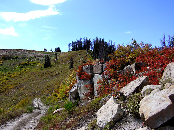 |
| Rocks and Red Leaves of Skyline Drive by
Eric Huish
©Eric Huish |
|
~ (submitted by Eric Huish Description: The Skyline Drive is one of the highest roads in the United States. The full drive is 87 miles long and traverses the summit of the Wasatch Plateau with mountain meadows, Fir and Aspen forests, boulder strewn hillsides and fantastic views in all directions. The South section between Fairview Canyon and I-70 is a very high elevation, rugged road and in some sections only suitable for high clearance four-wheel drive vehicles. The road is impassable except by snowmobile during winter, and can become impassable during summer storms. Directions: One way to access the Skyline Drive South section is to drive up Fairview Canyon (Hwy 31). Near the top of the canyon I think there is a sign (across from the turn off to Lower Gooseberry Reservoir and the Ranger Station) that says 'South Skyline Drive', turn right (Hwy 31). Then there should be another sign a few miles down the road, turn right again. You can access, or drop down off of, the South section of the Skyline Drive in many places - Manti Canyon for example. Take a good map with you if you plan on exploring more than just the area near Fairview Canyon. Specialty Birds: Hairy Woodpecker, Gray Jay, Steller's Jay, Clark's Nutcracker, Mountain Chickadee, Mountain Bluebird and Green-tailed Towhee. Other: Take your time and stop often. The South section, between Fairview Canyon and I-70, is a very high elevation, rugged road and in some sections only suitable for high clearance four-wheel drive vehicles. The road is impassable except by snowmobile during winter, and can become impassable during summer storms. eBird Data: |
Skyline Drive |Skline
Drive -- Tent Mtns |
Fairview Canyon | |
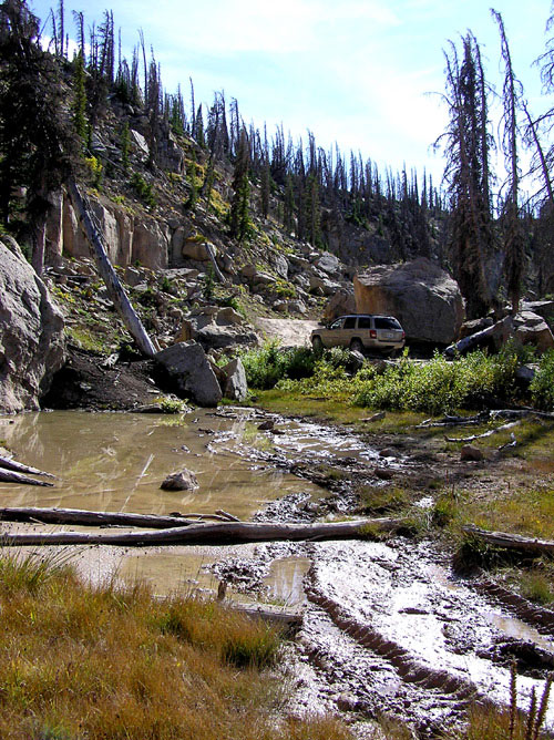 |
| South
Skyline Drive by
Eric Huish
©Eric Huish |